UMW adds new 5-year program for master’s in geospatial analysis
3 min read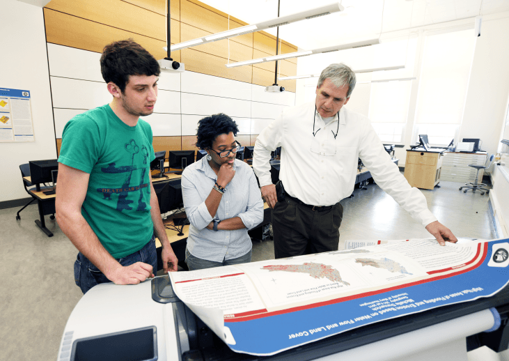
University Relations
By Rachel Manning
The University of Mary Washington has introduced a new accelerated five-year master’s program for Geographic Information Sciences studies. In 2014, UMW launched a program for a Master’s of Science in Geospatial Analysis, which was popular enough to start the new five-year master’s program this fall.
Students who have completed at least two classes towards the GIS certificate are eligible to apply. This new option offers GIS students more experience in their subject at a better price. The program is designed to fast-track hardworking students in attaining a degree.
“Graduate work tends to lead to more job opportunities and higher paying salaries,” said Brian Rizzo, associate professor and Director of the Center for Spatial Analysis and Research. “We found out that a lot of the graduate students who start out as full-time students end up getting a job halfway through the program, so the program actually helped secure them that job.”
Many jobs even require that candidates have substantial experience in GIS. Senior geography major, Michael Ryan said that the majority of the job applications he saw said that they prefer candidates to have a master’s in GIS.
“There are more jobs in GIS than there will ever be people to fill them,” said geography department chair, Jackie Gallagher. She also noted that GIS skills are incredibly valuable and versatile, and that has led students from many different disciplines to take interest in the GIS program.
“I’ve got English majors, I’ve got historic preservation majors, history, international affairs, political science, economics, marketing, biology, environmental science… Every single major,” Gallagher said. “You could apply it [GIS skills] to any major at all.”
GIS is essentially solving spatial problems with software. According to Gallagher, it is inherently tied to geography and location, but the problem could belong to any discipline. Ryan realized through his experience with the GIS program that it can be used for a lot more.
“It can be used for healthcare to see where hospitals are in relation to certain areas and how long it might take for an ambulance to get there,” Ryan said.
Any event that occurs in space can by analyzed with GIS. “The key thing that people don’t understand is that they don’t know what GIS is,” Rizzo said. “If they did some research on it in terms of how it would fit their particular field, they would be amazed… It’s all about mapping and looking at the location of things and understanding how location is important to the distribution of things.”
Gallagher hopes that the five-year master’s program will bring students interested in GIS studies to UMW. This seems likely, considering that, even before the program was initiated, UMW’s MGSA program was drawing new students in. Ryan began as a forestry major at West Virginia University, which already incorporates a large GIS component. When he decided to transfer to an in-state school, he chose UMW because of its GIS program.
Even if a student is not sure that they want to get a master’s degree in GIS, they can take some graduate-level classes while still an undergraduate to see whether it’s the right fit because of the new five-year program. Even if the student decides not to pursue a master’s in GIS, they will still have that much more experience with the subject.
“I think that being able to take one of the master’s courses at the same time that I’ll be doing my GIS certificate capstone internship will give me a glimpse of the professional track and the grad school track,” said junior geography major
Alistair Andrulis. “Hopefully, following this track will help me find what the best fit is for me after my undergraduate career.”
With this new five-year MSGA program, students have an even wider opportunity to take advantage of this cutting-edge discipline.
“GIS is such a booming subject now,” Ryan said. ”People map the ocean with it now. One day it will probably be used for something in space or something crazy.”